Riparian Buffer Establishment
Location
The Holston River arises in the foothills of the Blue Ridge Mountains and flows for approximately 274 miles through Virginia into Tennessee. The Holston River joins the French Broad River in Tennessee to form the Tennessee River.

The diversity
The Holston River in Virginia is made up of three major forks: North Fork, Middle Fork, and South Fork. The North Fork of the Holston River originates in Bland County and flows 100 miles through Virginia to Tennessee. While the North Fork Holston boasts a superb smallmouth bass (Micropterus dolomieu) recreational fishery, fish from the North Fork below Saltville, VA cannot be consumed due to mercury contamination.
The Middle Fork of the Holston River originates near the Smyth-Wythe County line and flows 56 miles to join the South Fork just southeast of Abingdon, VA in Washington County. The South Fork of the Holston River originates near Sugar Grove, VA and eventually joins the North Fork in Kingsport, TN.
The Holston River watershed is situated in Bland, Wythe, Smyth, Grayson, Scott, and Washington Counties which lie within the Mount Rogers Planning Region as designated under Virginia’s 2015 State Wildlife Action Plan. Of Virginia’s 883 Species of Greatest Conservation Need, 147 are dependent upon habitats provided within the Mount Rogers Planning Region. The Middle Fork and South Fork are also priority areas for the eastern hellbender (Cryptobranchus alleganiensis) with historical occurrences and recent survey results confirming presence of the species.
Big thanks to all of our project partners:
Featured Project
Chilhowie Town Park- Chilhowie, VA
The project
Location
The Chilhowie Town Park runs parallel to the Middle Fork Holston River in the Town of Chilhowie, VA.
The Problem
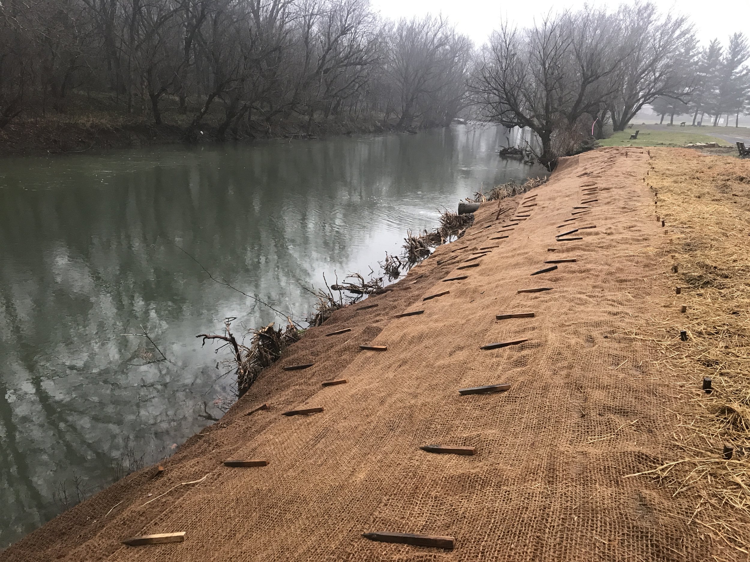
The multi-use park has pavilions, fishing access, a walking/running trail, and a playground. The streambanks were experiencing accelerated bank erosion along segments of the 3,200 ft reach. This erosion was caused primarily by regular maintenance and mowing of the banks by the town, and was therefore dominated by turf grass and little woody native riparian vegetation.
The result
The goal of this project was to reshape the vertically eroding banks, establish a riparian buffer, install rootwads to protect a stormwater culvert, and to place rock clusters throughout the reach to create more fish habitat. Additionally, several slab rock clusters were placed to help attract the illusive Eastern Hellbender. These slab rocks mimic the natural habitat that Hellbenders like to build their nests under.
In 2019, CVI will work to enhance nearly 1.5 acres of riparian buffer.
CVI’s partners in this project include:
Unique Features
At the Chilhowie Town Park project, CVI and our partners worked together to create some unique in-stream features. Eleven rock clusters were installed periodically throughout the reach. So much of this reach was uniform bedrock or small pebbles. Because of the lack of bedform diversity, fishing in this reach was negatively impacted. For this reason, two different cluster types were designed for this project. The first type was a simple four boulder cluster. These boulders were more rounded and were placed with the intent to create increased fish habitat.


